29-30TH OCTOBER 2016 | IMPERIAL COLLEGE ADVANCED HACKSPACE, LONDON
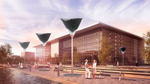
as part of Aerocene at Exhibition Road
Open Call: Aerocene HACK – open call. Exhibition Road, London
In late October 2016 the Aerocene project along with young scientists, designers, developers, and artists primarily from Exhibition Road institutions – Imperial College London and the Royal College of Art – came together for one weekend of intense collaboration to hack the Aerocene Backpack. It was an intense and inspiring two days of grappling with code, electronics, and the possibilities of Aerocene exploration in the Imperial College Advanced Hackspace (ICAH). We are thrilled to welcome some highly creative new members to our Aerocene family – their projects are documented below.
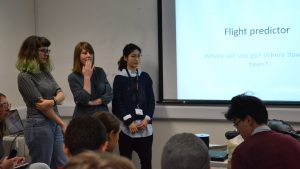
CHALLENGE #1: Hack the Aerocene Explorer flight predictor
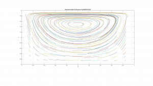
The current version of Aerocene Explorer is designed for tethered flight, but as we iterate towards cutting the tether we will need the means to predict its flight. Together with Prof. Glenn Flierl and Bill McKenna from MIT’s Earth, Atmospheric and Planetary Sciences (EAPS) department (via livestream from Boston), these teams worked on modelling, visualising and predicting the trajectories of a free Aerocene Explorer. The hacks were heavily inspired by an ongoing collaborative project between Aerocene and MIT EAPS to calculate predicted flight paths based on open GFS (Global Forecast System) data.
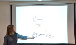
AEROCENE DASHBOARD
Evelien van Bokhorst, Yilan Lu, Elena Falomo
This hack was a mashup which added nearest cities or places of interest to Aerocene Explorer flight paths. It could either be applied to trajectory predictions to show the user possible destinations for their Aerocene Explorer flight, or to past flight trajectories, telling the story of completed journeys.

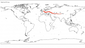
MAPPING FLIGHT PATHS FOR PHOTOGRAMMETRY
Rachel Yalisove
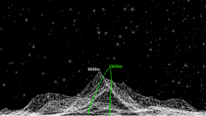
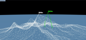
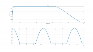
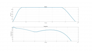
This hack looked into the theoretical use of the diurnally fluctuating altitudes of Aerocene Explorer free flights to map topographical features using photogrametry. Visualisation of a former Aerocene Explorer flight path in relation to Mount Everest gave a new perspective to the data.
THERMOMECH SCULPTURES
Marco Ghilardi, Ahmed Asiliskender
This hack attempted to build a dynamic model of the flight of a free-flying Aerocene Explorer based on models of buoyancy and of the wind. In a second part, the team explored the possibility of predicting the trajectory of Aerocene Explorer free flight once it reaches altitudes over 18 000m where GPS tracking systems must legally be disabled.
CHALLENGE #2: Hack Aerocene Explorer hardware
In this second challenge the Aerocene Backpack, developed by the Aerocene team and collaborators, was offered as a starting point for iteration. How could the existing technology be tweaked or remixed, adding new functions and creating new possibilities to use it as a platform for exploring the air. The hack teams were supported by members of the Aerocene team both on site and via livestream from Berlin.
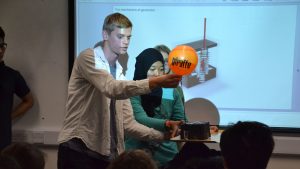
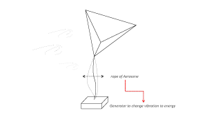
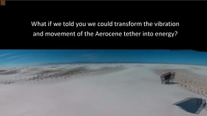
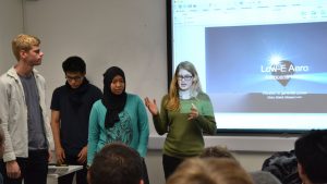
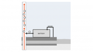
LOW-E AERO
Elinor Merkier, Larasati, Minwoo Kim, Kristof van der Fluit
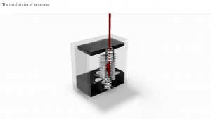
This hack looked at using a piezoelectric transducer to convert movement of the Aerocene Explorer tether into electricity. This could be used to power LED’s on the Explorer’s surface, visualising the power of the wind, or other low energy components of the hardware payload.
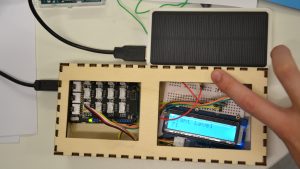
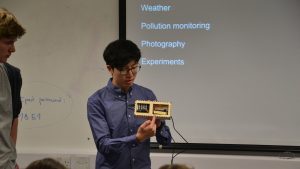
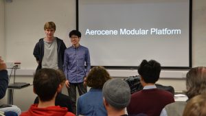
AEROCENE MODULAR PLATFORM
James Formby, Lok Chun Fan
This hack aimed to convert the Aerocene Explorer into a user-friendly plug-and-play platform for data collection. The user would be able to easily attach different sensors – data would be displayed on an LCD screen which can be attached at base. Possible applications include monitoring local weather, air pollution levels, or to create a mesh network for communications.
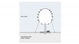
PARTICULARLY
Florian Tiefenbach, Andrea Pisa, Andrea Carrera
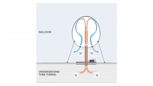
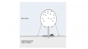
This hack proposed using heat emitted from underground systems to keep the Aerocene Explorer sculpture inflated independent of weather conditions. Air entering the sculptures would be electrically charged by a live wire, creating static charge at the surface to attracts pollution particles, cleaning the air and collecting samples for air quality monitoring.
We would like to extend a huge thanks to Jing, Audrey, Sabine, Kitty and Raj from ICAH for welcoming us into their hackspace and supporting us with their expertise and experience. Likewise, we would like to thank Carlo and the Exhibition Road Commission – supported by the Exhibition Road Cultural Group (16 prestigious cultural and scientific institutions, including Imperial College London, the Natural History Museum, the Victoria and Albert Museum, and Serpentine Galleries amongst others), Arts Council England, South Kensington Estates and our Founding Patrons: Francesca von Habsburg, Maja Hoffmann and Nicoletta Fiorucci – for bringing the Aerocene project to Exhibition Road to create this unique platform for collaboration between Exhibition Road institutions.